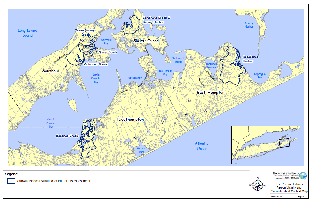
Map of 2013 subwatershed Plans
Map of 2013 subwatershed Plans (PNG)
Dodatne informacije
| Polje | Vrednost |
|---|---|
| Podaci ažurirani poslednji put | 1. oktobar 2025. |
| Meta podaci ažurirani poslednji put | 18. februar 2026. |
| Kreirano | 1. oktobar 2025. |
| Format | PNG |
| Licenca | Licenca Nije Pružena |
| Datastore active | False |
| Has views | True |
| Id | fef09795-dd9f-4f7b-bdae-3bb031c82bda |
| Mimetype | image/png |
| Package id | 059464d1-7656-4d08-95fb-3f29d06de528 |
| Position | 9 |
| Size | 345 KB |
| State | active |
| Url type | upload |